
Join us as we travel 12 miles north through the scenic Ozarks along Arkansas Highway 125, beginning at Highway 14 and ending at one of Arkansas’s most unique highway features — the Peel Ferry crossing on Bull Shoals Lake. This stretch of highway is a beautiful and often overlooked route that winds through low ridgelines, dense woodland, and quiet communities, eventually delivering travelers to the only ferry-operated state highway connection in the Natural State.
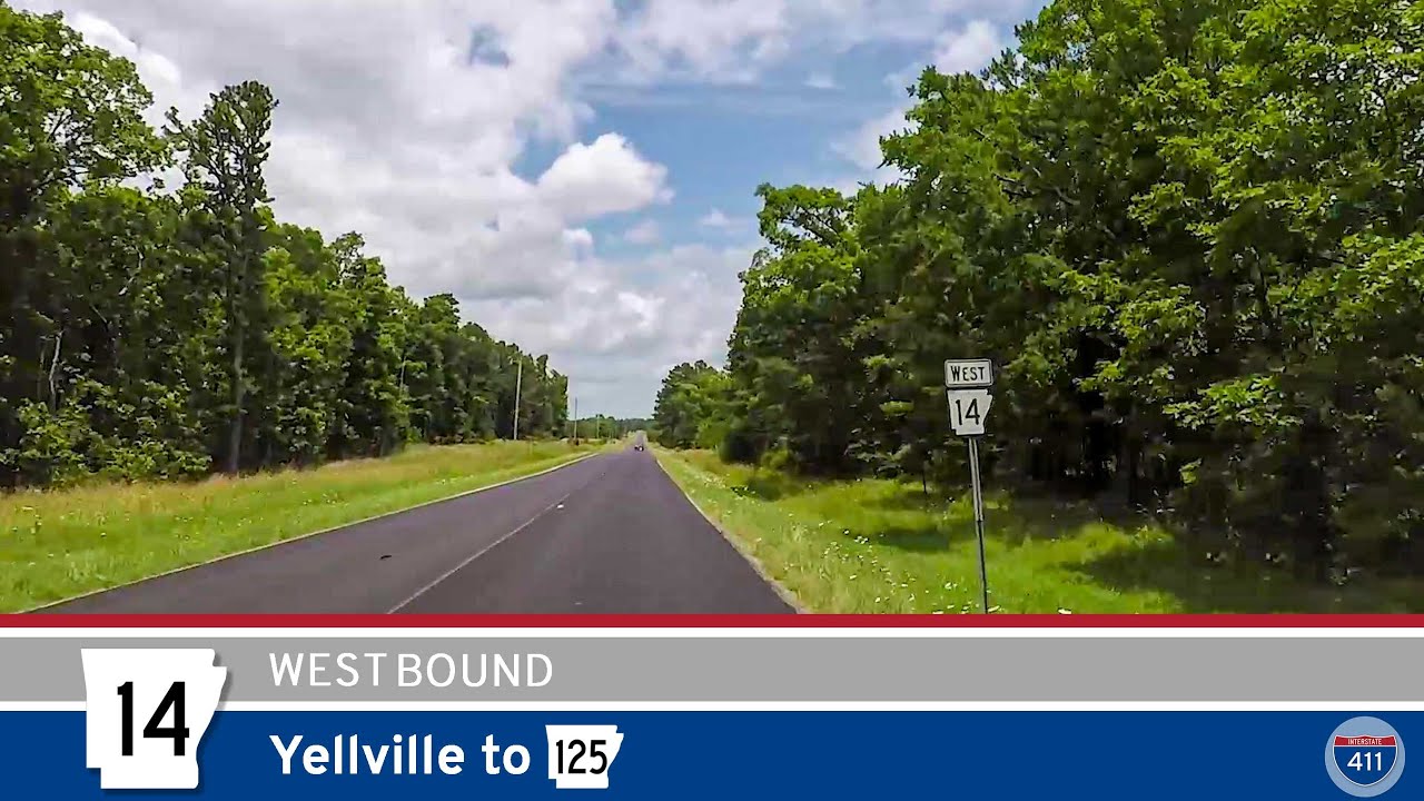
We begin our journey at the junction with Arkansas Highway 14, located roughly 15 miles north of Yellville in Marion County. From here, Highway 125 immediately embarks on a peaceful and gradually descending course through the hills of northern Arkansas. The road twists and turns through a series of low mountains, giving drivers glimpses of wooded hollows and narrow ridgelines typical of the Ozark Plateau. There’s a timeless quality to this area — no billboards, no gas stations, no shoulder-to-shoulder development. It’s just you, the road, and the sound of tires humming over pavement.
About five miles north of the Highway 14 junction, we pass the intersection with Locust Road, which continues westward as Arkansas Highway 268. While AR-268 serves as a local connector route, our path remains on AR-125, drawing us deeper into the tranquility of this remote region. Shortly after passing AR-268, the forest canopy thickens. Here, the natural scenery begins to subtly change as the terrain signals our approach to Bull Shoals Lake.
As we approach the lakeside community of Peel, the descent becomes more noticeable. The highway gently winds its way downhill, offering glimpses of Bull Shoals Lake through the trees. Peel itself is a small but important waypoint — mostly known for its access to the ferry and the surrounding recreational areas. The community offers a few amenities for travelers including a boat ramp, campground, and picnic areas within the Hwy 125 Use Area, which we pass through just before reaching the ferry landing.
This portion of the drive is worth taking slowly, not only for the occasional sharp curve but for the quiet charm it presents. If you’re lucky, you might catch sight of deer or wild turkeys meandering along the roadside, especially in the early morning or late afternoon hours. The landscape opens up just as we enter the Hwy 125 Use Area, which includes parking areas, a small park, and lake access — all operated by the U.S. Army Corps of Engineers. It’s a great place to pause and take in the expansive views of Bull Shoals Lake before boarding the ferry.
Our video ends as we roll down the final slope toward the ferry landing, pulling directly onto the deck of the Peel Ferry. This ferry is the only remaining public ferry in Arkansas and continues to serve as a vital connection for residents and travelers alike, linking the two halves of Highway 125 across Bull Shoals Lake. The crossing itself takes about 10 minutes, offering a relaxing ride across the water and a unique experience that can’t be found on most highway routes.
🗺️ Route Map
0 Comments